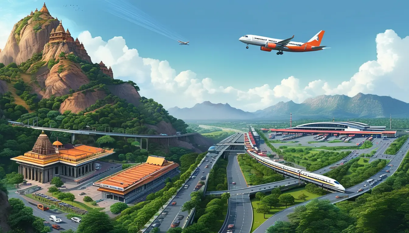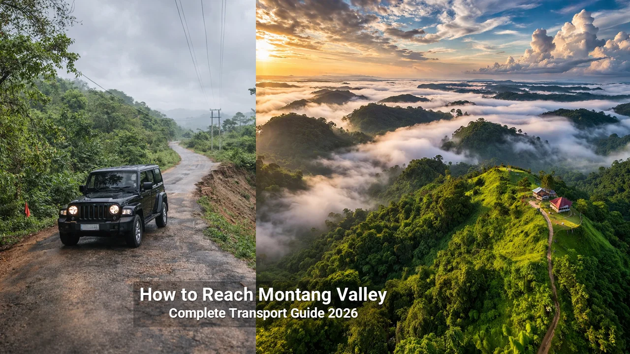
If you’re planning a trip to Montang Valley in Tripura, getting there is the biggest challenge – and the most important thing to get right. This guide covers every route, every mode of transport, and every honest reality you need to know before you go.
We drove this route ourselves and spoke with local drivers in Agartala and Teliamura while preparing this guide.
Quick Answer: How to Reach Montang Valley
| Question | Answer |
|---|---|
| Nearest airport | Agartala (IXA) – 63–80 km (Google Map Pin for Agartala Airport) |
| Nearest railway station | Teliamura (TLMR) – 30 km (Google Map Pin for Teliamura Railway Station) |
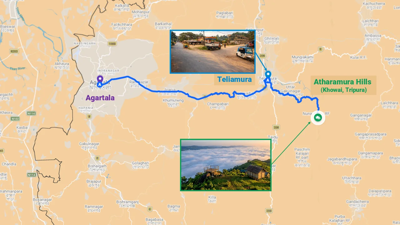
| Best route | Agartala → NH-8 → Teliamura → Chakmaghat → Montang |
| Final stretch | 17–30 km narrow mountain road (SUV required) |
| Public transport | Available only till Teliamura/Agartala |
| Ideal departure time | 4:00 AM from Agartala for sunrise clouds |
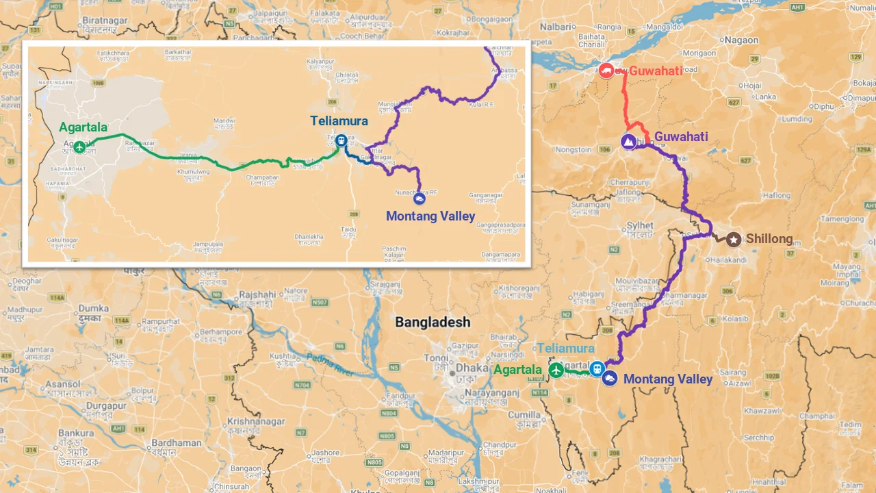
Table of Contents
Why Getting to Montang Requires Real Planning
Montang Valley sits 63–80 km from Agartala, deep in the Atharamura hills of Khowai district. While the distance isn’t extreme, the final 17–30 km serpentine track makes this journey one that demands preparation.
There’s no public bus to the summit. The road is narrow, winding, and often bumpy. Mobile networks vanish after Teliamura. And if you’re coming from Guwahati, Shillong, or Silchar, you’re looking at a multi‑day journey through some of Northeast India’s most beautiful – and challenging – terrain.
This guide covers every route. You’ll find road conditions, train schedules, flight options, overnight stopovers, and the honest reality of traveling in Tripura’s hill country.
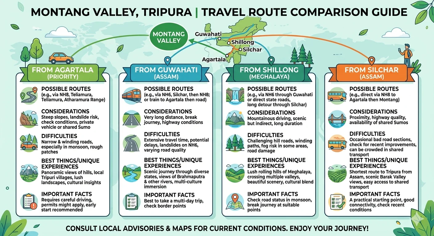
Primary Route: From Agartala (Most Common)
| Detail | Information |
|---|---|
| Distance | 63–80 km (varies by starting point) |
| Travel time | 1.5–2.5 hours |
| Route | Agartala → NH-8 → Baramura hills → Teliamura → Chakmaghat → 17–30 km mountain track → Montang summit |
Step-by-Step Breakdown of Agartala to Montang Valley Route
| Step | Landmark | Action |
|---|---|---|
| 1 | Agartala city | Depart by 4:00 AM |
| 2 | Baramura hills | Pass through scenic hills on NH-8 |
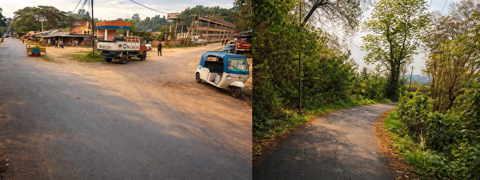
| 3 | Teliamura market | Continue straight |
| 4 | Chakmaghat market | Proceed toward the barrage |
| 5 | Chakmaghat barrage | Sharp right turn across Khowai River bridge |
| 6 | Mountain track | Follow 17–30 km serpentine road |
| 7 | Montang summit | Arrive by 5:30 AM for the “sea of clouds” |
Best Time to Start the Drive
Depart Agartala by 4:00 AM. This is non‑negotiable if you want to see the floating clouds. The phenomenon is most spectacular in the first hour after sunrise. Arriving later means clouds have already burned off – and you’ll face crowds.
Where to Refuel
- Last reliable petrol pump: Teliamura market (before the mountain track)
- No fuel available on the final 30 km stretch
Where Network Disappears
- Mobile signal: Strong till Teliamura. After Chakmaghat, expect patchy to zero connectivity.
- Jio and BSNL work slightly better than other providers – but download offline maps anyway.
Last ATM Before Montang
- Teliamura market – withdraw cash here. There are no ATMs after this point.
Transport Options from Agartala
| Option | Details | Approx. Cost (2026) | Best For |
|---|---|---|---|
| Private SUV rental | Full day, driver included | ₹2,500–₹4,000 | Groups, families, comfort |
| Self-drive rental | SUV from Agartala car rentals | ₹1,800–₹3,000/day | Experienced drivers |
| Taxi (one-way/round) | Negotiate waiting time | ₹2,500–₹3,500 | Flexibility |
| Shared taxi | Very rare – may get to Teliamura only | ₹200–₹300 per person | Budget (no onward from Teliamura) |
Scenic Spots Along the Way
- Bondebota Temple – A peaceful roadside shrine
- Baramura Eco-park – Quick stop for nature walks
- Chakmaghat barrage – Khowai River views before the final climb
From Teliamura to Montang Valley
| Detail | Information |
|---|---|
| Distance | 30 km |
| Travel time | 1–1.5 hours |
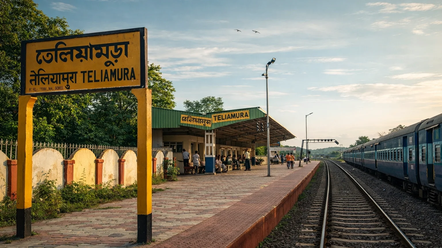
Teliamura is the closest town with a railway station (TLMR). If you arrive by train, you’ll need transport from here.
Options from Teliamura
- Pre-booked SUV: Arrange through your hotel or a local contact. Cost: ₹1,500–₹2,500.
- Local taxi: Limited availability – ask at the station. Expect to negotiate.
- Two-wheeler: Not recommended – steep slopes and narrow roads.
⚠️ Critical: There is no public bus from Teliamura to Montang. Do not arrive without confirmed transport.
From Dharmanagar (Northern Tripura)
| Detail | Information |
|---|---|
| Distance | ~115 km |
| Travel time | 3.5–4.5 hours |
| Route | Dharmanagar → NH-8 southbound → Teliamura → Montang |
Suitable for: Travelers from northern Tripura, Mizoram border areas, or Assam via Karimganj.
Transport Options
| Option | Details | Approx. Cost |
|---|---|---|
| Private SUV from Dharmanagar | Full day rental | ₹3,500–₹5,000 |
| Bus to Teliamura | State transport buses | ₹150–₹250 |
| Then local taxi from Teliamura | As above | ₹1,500–₹2,500 |
Pro tip: Leave by 6 AM to reach Teliamura before noon, giving you time to arrange the final leg.
From Silchar, Assam (Closest Major City Outside Tripura)
| Detail | Information |
|---|---|
| Distance | ~210 km |
| Travel time | 4–6 hours |
| Route | Silchar → Karimganj → NH-8 → Churaibari (Assam-Tripura border) → Teliamura → Montang |
Transport Options for Silchar to Montang Valley Route
| Option | Details | Approx. Cost |
|---|---|---|
| Shared taxi | Frequent from Silchar to Agartala/Teliamura | ₹400–₹700 per person |
| Bus | Regular services to Teliamura | ₹300–₹500 |
| Private SUV from Silchar | Full day with driver | ₹6,000–₹8,000 |
| Then Agartala → Montang | As per Section 1 | ₹2,500–₹4,000 |
Critical Bottleneck: The Gammon Bridge at Badarpur
The Gammon Bridge is a major structural chokepoint on this route. It frequently undergoes maintenance closures (sometimes for 60 days at a time) . During closures, traffic diverts via the Silchar–Kalain route, adding 1–2 hours to the journey.
Before traveling, check:
- Local news or ask at the Silchar bus stand
- Whether the bridge is open or under maintenance
- Alternative routes if closed
Unique Experiences Along This Route
- Khaspur ruins (Dimasa Kingdom) – near Silchar, a worthwhile stop
- Unakoti rock carvings – if you’re continuing north, this can be combined
From Shillong, Meghalaya
| Detail | Information |
|---|---|
| Distance | ~460 km |
| Travel time | 15 hours by bus; 10–12 hours by private vehicle |
| Route | Shillong → NH-6 → Lad Rambai (Jaintia Hills) → Churaibari (Tripura border) → NH-8 → Teliamura → Montang |
Transport Options
| Option | Details | Approx. Cost |
|---|---|---|
| Bus | Departs near Shillong Cathedral Church ~6:00 PM (transit buses originating in Guwahati) | ₹800–₹1,500 |
| Private SUV | Full day rental, can break journey | ₹8,000–₹12,000 |
| Self-drive | For experienced drivers; ensure high ground clearance | Variable |
Important Considerations
- Book bus tickets in advance – these are often transit buses from Guwahati, so seats fill quickly.
- Roughly 300 km of the 460 km route is mountainous with average to poor road conditions.
- Road travel via NH-6/NH-8 can be arduous – monsoons frequently cause landslides and traffic blocks (some travelers report being “stuck for 36 hours”).
Unique Experiences Along This Route
- Laitlum Canyons – dramatic views, just outside Shillong
- Jaintia Hills – some of the most dramatic landscapes in the Northeast
From Guwahati to Montang Valley (Primary Gateway)
| Detail | Information |
|---|---|
| Distance | 450–500 km |
| Travel time | Varies by mode |
Option A: By Train (Recommended for Scenery & Reliability)
| Train | From Guwahati (GHY) | To Teliamura (TLMR) | Travel Time | Days |
|---|---|---|---|---|
| Agtl Tejas Rajdhani (20502) | 03:25 | 14:33 | ~11 hrs | Friday |
| Agtl Humsafar (12503) | 12:55 | 00:40 | ~11:45 hrs | Sunday |
| Nnge Agtl Exp (15650) | 17:00 | 05:22 | ~12:22 hrs | Daily |
From Teliamura station, arrange an SUV to Montang (1–1.5 hours, ₹1,500–₹2,500).
Unique experience: The rail route is highly scenic, passing through the lush hills of Dima Hasao and the Barak Valley.
Option B: By Air (Fastest)
| Step | Details | Cost |
|---|---|---|
| 1 | Guwahati (GAU) → Agartala (IXA) | 1 hour flight: ₹2,600–₹10,000 |
| 2 | Agartala → Montang | 1.5–2.5 hours by SUV: ₹2,500–₹4,000 |
Airlines: IndiGo, Starlight Air (regular flights).
Option C: By Road (Longest, but Flexible)
| Route | Distance | Travel Time |
|---|---|---|
| Guwahati → NH-27 → NH-6 → NH-8 → Teliamura → Montang | 450–500 km | 16–20 hours |
Bus operators:
- Rayan Travels – daily services
- Seema Travels – daily services
- Buses depart from ISBT Guwahati
Considerations:
- FASTag is mandatory for Assam highway sections – ensure yours is active and funded.
- Monsoon risks: Heavy rains can cause landslides and long traffic blocks.
Where to Break Your Journey (Real Itinerary Advice)
If you’re traveling from Guwahati, Shillong, or anywhere outside Tripura, don’t try to drive straight to Montang in one go. Break the journey.
Best Overnight Stops
| Stopover | Distance from Montang | Why Stay Here |
|---|---|---|
| Agartala | 63–80 km | Best comfort – good hotels, restaurants, vehicle rental options |
| Silchar | ~210 km | Most practical midway stop if driving from Guwahati/Shillong |
| Teliamura | 30 km | Closest – but very basic accommodation; only if you must |
Ideal 2‑Day Plan (From Guwahati/Shillong)
| Day | Plan |
|---|---|
| Day 1 | Travel from Guwahati/Shillong → Reach Agartala (by flight) or Silchar (by road). Stay overnight. |
| Day 2 | Depart by 4:00 AM from Agartala (or early from Silchar) → Montang sunrise → Return to Agartala by afternoon |
Where to Stay Midway: Guwahati to Tripura Road Trip
If you’re driving all the way from Guwahati:
- First day: Guwahati → Silchar (~300 km, 8–9 hours). Stay overnight in Silchar.
- Second day: Silchar → Agartala → Montang (depart Silchar by 3:00 AM to reach Montang by sunrise, or stay in Agartala and do Montang on Day 3).
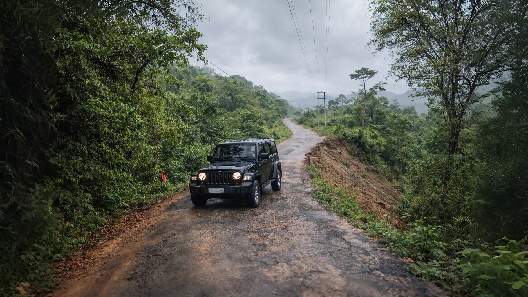
The Final 30 km – What to Expect
This is the section that determines whether your trip succeeds or becomes a struggle.
| Factor | Reality |
|---|---|
| Surface | Paved (PMGSY road) but narrow – barely wide enough for two small cars |
| Condition | Bumpy – steep slopes, potholes, uneven stretches |
| Length | 17–30 km (sources vary) |
| Navigation | Google Maps works but download offline maps – signal drops |
| Time | 1–1.5 hours for the final stretch (not 30 minutes!) |
| Vehicle recommendation | SUV only – high ground clearance essential |
⚠️ Monsoon warning: During heavy rain, this road becomes dangerous. Landslides are common. If traveling June–September, check the forecast and consider postponing.
By Train – Complete Station Guide
| Station | Code | Distance to Montang | Best For |
|---|---|---|---|
| Teliamura | TLMR | ~30 km | Closest – ideal if you can get a ticket |
| Agartala | AGTL | 63–80 km | More train options; then SUV rental |
Train Booking Tips
- Book at least 2 weeks in advance – Northeast trains fill quickly.
- For Tejas Rajdhani (20502), set a reminder – tickets open 120 days in advance and sell out within hours.
- If Teliamura tickets are unavailable, book to Agartala.
By Air – Airport Options
| Airport | Code | Distance to Montang | Connectivity |
|---|---|---|---|
| Agartala | IXA | 63–80 km | Direct flights from Kolkata, Delhi, Guwahati, Bengaluru |
| Guwahati | GAU | 450–500 km | Major hub; connect to IXA or continue by road/train |
From Agartala Airport
- Pre-paid taxi counters are available outside arrivals.
- Cost to Montang: ₹2,500–₹3,500 (negotiate).
- Better option: Arrange an SUV through your hotel in advance – often cheaper and more reliable.
Vehicle Rental Recommendations
| City | Recommended Rental | Contact | Vehicle Type |
|---|---|---|---|
| Agartala | Agartala City Cab | 9862661838 | SUV (Innova, XUV) |
| Agartala | Dollar Starline Travels | 9100114919 | SUV, tempo traveler |
| Teliamura | Ask at your hotel or market | – | Local SUVs (limited) |
| Silchar | Local car rental agencies | – | Innova preferred |
Pro tip: When booking, explicitly request an SUV with high ground clearance. “SUV” in Northeast sometimes means a small hatchback – clarify.
Travel Tips by Season
| Season | Road Condition | Recommendation |
|---|---|---|
| Winter (Oct–Feb) | Best – dry roads, clear visibility | Depart Agartala by 4:00 AM to catch sunrise clouds |
| Summer (Mar–May) | Good – but hot in the plains | Carry water, start early to avoid heat |
| Monsoon (Jun–Sep) | Risky – landslides, slippery tracks, traffic blocks | Avoid unless absolutely necessary |
Monsoon warning from traveler reports: “Stuck for 36 hours” due to landslides is not uncommon on NH-6/NH-8 during heavy rain.
Comparison Table – From All Origins
| Origin | Distance | Travel Time | Best Mode | Estimated Cost (One-Way) |
|---|---|---|---|---|
| Agartala | 63–80 km | 1.5–2.5 hrs | SUV rental | ₹2,500–₹4,000 |
| Teliamura | 30 km | 1–1.5 hrs | Local SUV | ₹1,500–₹2,500 |
| Dharmanagar | ~115 km | 3.5–4.5 hrs | Private vehicle | ₹3,500–₹5,000 |
| Silchar | ~210 km | 4–6 hrs | Shared taxi / private SUV | ₹400–₹8,000 |
| Shillong | ~460 km | 10–15 hrs | Bus / private SUV | ₹800–₹12,000 |
| Guwahati (by air) | 450–500 km | 3–4 hrs total | Flight + SUV | ₹5,000–₹14,000 |
| Guwahati (by train) | 450–500 km | 11–12 hrs | Train + local SUV | ₹1,800–₹5,000 |
| Guwahati (by road) | 450–500 km | 16–20 hrs | Bus / self-drive | ₹1,200–₹6,000 |
Best Route Based on Your Travel Style
| If you want… | Choose this route |
|---|---|
| Fastest route | Fly to Agartala (IXA) + SUV to Montang |
| Cheapest route | Train to Teliamura (TLMR) + local taxi/SUV |
| Most scenic journey | Train from Guwahati to Teliamura (Tejas Rajdhani) |
| Road trip adventure | Drive from Silchar or Shillong (allow 2 days) |
| Weekend getaway from Agartala | Direct SUV rental, depart 4:00 AM |
Critical Facts for All Routes
| Category | What You Need to Know |
|---|---|
| Vehicle requirement | High-ground-clearance SUV strongly recommended for the final ascent |
| FASTag | Mandatory for Assam highway sections – ensure active and funded |
| Mobile network | Patchy beyond Teliamura – download offline maps |
| Water & food | Scarcity at summit – carry your own potable water and snacks |
| Cash | No ATMs near Montang; shops and informal fees are cash-only |
| Night travel | Avoid traveling outside urban centers after sundown – unlit roads, limited emergency services |
| Safety & land issues | Ongoing land dispute at summit leads to informal pricing – expect ₹25 for 500ml water, high parking fees. Not dangerous, but be prepared. |
FAQs: How to Reach Montang Valley
Is Montang Valley in Tripura or Nagaland?
The officially named Montang Valley is in Tripura. The Nagaland “Montang” refers to cloud viewpoints near Pfutsero. Read our confusion‑clarifying pillar article for the full story.
Is Montang Valley accessible by car?
Yes – but only by SUV or high‑ground‑clearance vehicle. Sedans are not recommended for the final 30 km stretch.
Which is the nearest railway station to Montang Valley?
Teliamura (TLMR) is the closest, just 30 km from the summit. Agartala (AGTL) is another option with more train services.
Can I do a day trip to Montang Valley from Agartala?
Yes – and most visitors do. Depart Agartala by 4:00 AM, spend 2–3 hours at the summit, and return by early afternoon.
Is driving to Montang Valley difficult?
The final 30 km is narrow, winding, and sometimes bumpy. It requires careful driving, especially during monsoon. Not difficult for an experienced driver in an SUV, but not a casual drive.
Do I need an SUV for Montang Valley?
Strongly recommended. The road has steep slopes, potholes, and uneven surfaces. A sedan will struggle – and you risk damage.
What’s the best way to reach Montang Valley from outside Northeast India?
Fly to Guwahati (GAU), then take a connecting flight to Agartala (IXA). From Agartala airport, hire a pre‑arranged SUV. This is the fastest, most reliable route.
Is there public transport to Montang Valley?
Only till Teliamura or Agartala. The final 30 km has no public bus – you must arrange a private vehicle.
How early should I leave Agartala to see the floating clouds?
Depart by 4:00 AM to reach the summit by 5:30 AM. The clouds are most spectacular in the first hour after sunrise.
What’s the cost of a taxi from Agartala to Montang?
₹2,500–₹4,000 for a round trip (waiting time included). Confirm whether fuel and driver allowance are included.
Is the Gammon Bridge on the Silchar route open?
Check before travel. This bridge frequently undergoes maintenance closures (sometimes for 60 days). If closed, traffic diverts via Silchar–Kalain route, adding 1–2 hours.
Do I need FASTag for this trip?
Yes, if traveling by road through Assam (Guwahati, Shillong, Silchar routes). FASTag is mandatory on Assam highways.
Is it safe to travel during monsoon?
Not recommended. Landslides and road closures are common. Travelers have reported being “stuck for 36 hours” on NH-6/NH-8 during heavy rain.
Final Verdict: Is Montang Valley Easy to Reach?
| Question | Answer |
|---|---|
| Easy to reach from Agartala? | Yes – with a private SUV and 4:00 AM departure, it’s a straightforward half‑day trip. |
| Easy to reach from outside Tripura? | Requires planning – but doable with a 2‑day itinerary and advance bookings. |
| Worth the effort? | Yes – the floating clouds at sunrise are genuinely spectacular, and the journey itself is an adventure through some of Northeast India’s most beautiful terrain. |
Montang Valley isn’t a place you stumble upon. It’s a destination you choose – and that choice comes with a road that demands respect. Go prepared, drive carefully, and you’ll earn one of the most memorable sunrises in Northeast India.
What’s Next in the Montang Series
This article is part of our Montang Valley content cluster:
| Article | Purpose |
|---|---|
| Montang Valley: Tripura or Nagaland? (Pillar) | Clarify naming confusion |
| Montang Valley Tripura Travel Guide | Full destination planning |
| You are here: How to Reach Montang Valley | Detailed logistics |
| Montang Valley Homestays & Facilities (Upcoming) | Accommodation deep‑dive |
| Is Montang Valley Worth Visiting? (Upcoming) | Honest value assessment |
From this article, explore other Northeast road trips:
- Kamakhya to Kohima: A Cultural Journey – another iconic Northeast route
- Solo Female Travel Safety Guide for Northeast India – essential reading for road trips
- Ziro Valley Travel Guide – more offbeat Northeast destinations
Last updated: March 2026. We monitor road conditions, train schedules, and land dispute updates quarterly. Check back for the latest.