

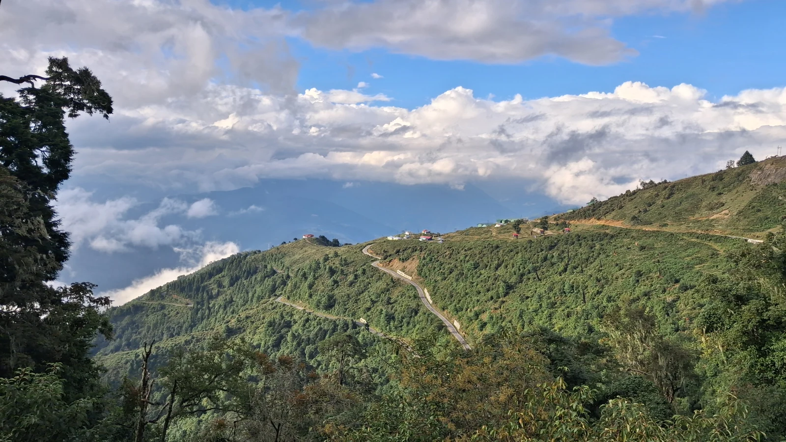
Neha’s account of a Mandala Top road trip through Shergaon, Bomdila and Dirang, written up from her notes and the family’s photographs, with additional research by Blake Ahadi.
We got back into the car at Mandala Top and I was scared. An unknown narrow road with hairpin bends, a road by the cliffs, dense forest, heavy fog, almost zero visibility. Our children were with us, and my husband is not an expert driver.
I was confused about how to say this to him. I guessed he was worried too, and I didn’t want to add to that. But I couldn’t hold it in either. So I asked in a different way: “How did you drive last 5–10 min to reach here?”
“I didn’t drive,” he said. “And I know what you mean. Yes, we will reach safely if we appreciate this situation properly.”
I didn’t understand what he meant, but I knew that he was not lying.
Planning this trip? Jump to the route comparison, timing, stops and tips for travelling with children, or read our story first.
Why we chose a Shergaon–Bomdila–Dirang road trip
To explain how we came to be on that road with our children, I have to go back to how we planned the trip. Earlier, we had visited the Nameri area and extended that visit into Arunachal Pradesh, from Bhalukpong up to Jamiri. It was fantastic, and it inspired us to travel more in Arunachal. So we started planning again, and we found Shergaon, Bomdila, Mandala Top and Dirang with Sangti Valley for a trip in mid-September 2026. But the routes were tricky to choose from.
If we chose Shergaon–Bomdila–Dirang, we would miss Mandala Top. We read that the Bomdila route was smoother and wider, while Mandala Top was more scenic. But opinions on Mandala Top were split: one said no proper road, very rough and narrow; another said it was fine and very scenic. We have kids, so we had to be very careful in planning.
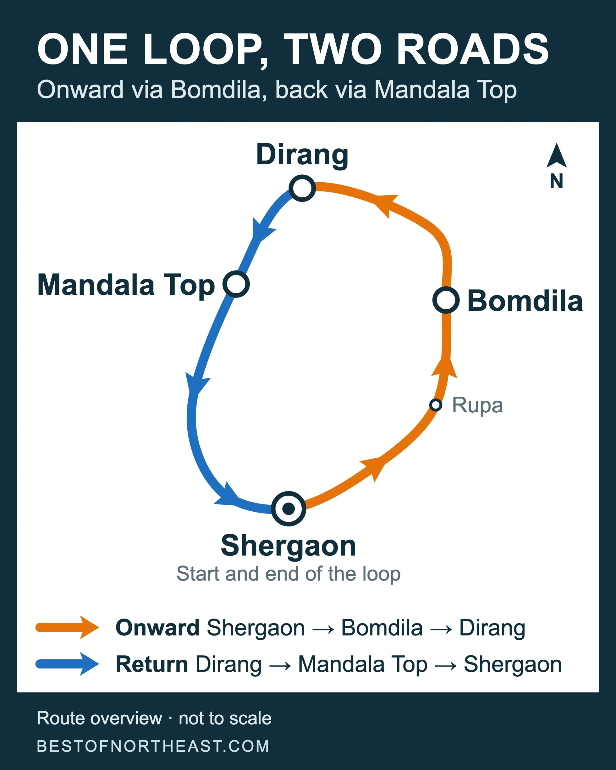
So we planned a loop, with a decision still to make. Onward, we would take Shergaon–Bomdila–Dirang, which we could reach without much trouble. While travelling, we would ask about the Mandala Top route, and if it sounded suitable, we would return to Shergaon that way.
Guwahati to Shergaon was a fantastic route, except for the navigation. Before Bhairabkunda, Google Maps sent us onto single-lane rural roads, which were pathetic. From the Assam–Arunachal check post at Bhairabkunda, the road was narrower, though not very tough, and very scenic. After some time it was a perfect road to Shergaon, the famous scenic Trans-Himalayan route. Our host at Dorjee Homestay in Shergaon was fantastic, and we will write about that stay separately.
The pleasure of stopping along the way
Every time we travel, we say, “We are not going for an interview. We are enjoying the abundance of beauty.” So we stop where we want, where we want to see more, where we want to test something new. On the road from Shergaon through Bomdila to Dirang, this principle rewarded us beyond our most beautiful dream. It helped our children’s comfort and our enjoyment of nature’s beauty.
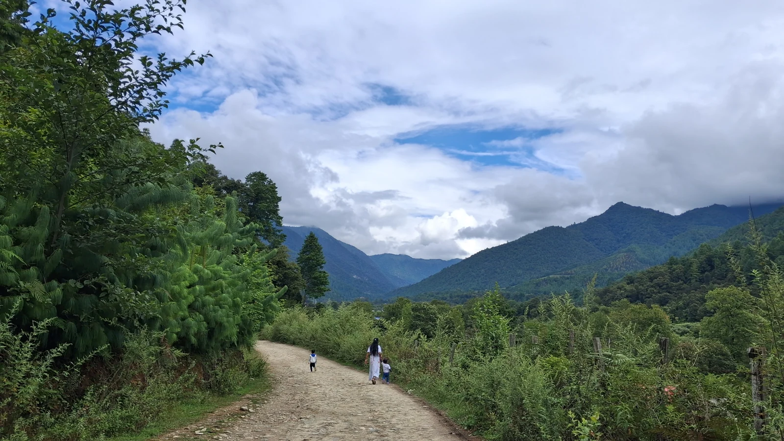
We stopped at almost every place along the way. Near Shila Point, about midway between Shergaon and Bomdila, a stream ran below green slopes. Around Rupa, the river opened out into a wide valley.
At the monastery in Bomdila, the children were at the steps putting their shoes back on.
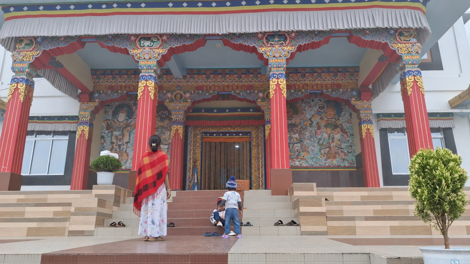
Our second night surprised us. Tenzin Homestay at Rama Camp is not a homestay at all. It’s a budget hotel or lodge, though considering its low price, we can say it’s okay.
Then, suddenly, we changed our plan. Tawang was not on our list. But in the morning, something happened to us, and we started towards Tawang instead of Sangti Valley. That journey and our stay in Sangti Valley are for upcoming articles.
By then we had collected enough information about Mandala Top from locals and homestay hosts. They confirmed the route was fine, but narrower, and all of them said it was more scenic than the Bomdila route. Our Dorjee Homestay host encouraged us to take it if we were comfortable with frequent hairpin turns. Oh, yes. We had already enjoyed the Tawang trip. With almost no traffic, he said, we would feel better than on a wider, busy road. So we decided: Dirang, Mandala Top, Shergaon.
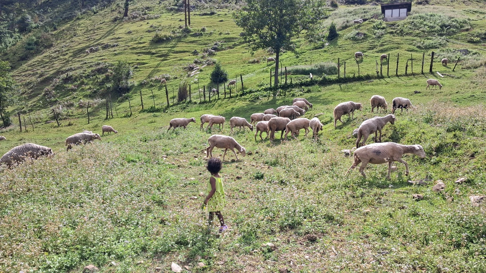
From Dirang to Mandala Top, above the clouds
Our Dorjee Homestay host was absolutely correct. It was amazing. After 10–15 minutes from Dirang, the real hairpin bends started, and almost every turn was a Windows wallpaper. We stopped frequently to see the view. Those stops did two things: they relaxed and comforted the kids while we enjoyed the views and took photos. We had spent so much time wondering which account of this road to believe. Now we were enjoying it for ourselves.
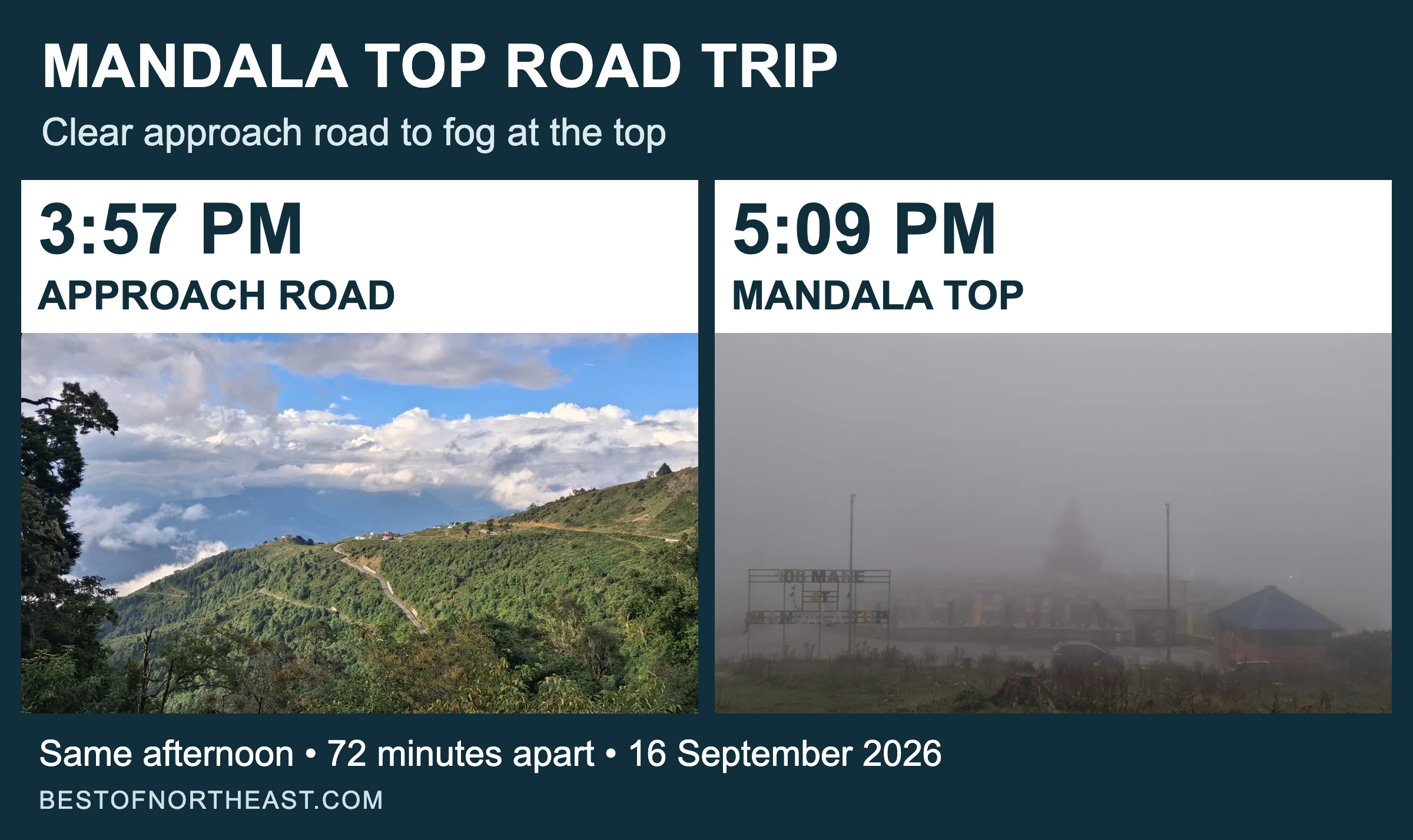
Ninety percent of the route to Mandala Top was fantastic and enjoyable. Just before reaching the top, we noticed it was getting slightly dark. Dramatically, within 10–15 minutes, it became almost zero visibility. When we reached Mandala Top, it was full of fog.
We had reached, but we didn’t dare to come out and see the actual attraction. The fog and cold were too sudden, the kids might catch cold, and there was no visibility to see anything. My husband got down, took some photos and started searching for a shop or restaurant. He found only one: the restaurant at Mandala Abode homestay. The homestay was closed, but the restaurant was open. Only our family and the restaurant people were there. We drove very close to the restaurant door and quickly went in for snacks and tea. That’s a different kind of restaurant. If you visit Mandala Top, we recommend having something there.
From Mandala Top to Shergaon, in fog and then darkness
After our tea we got back into the car, and that was the conversation I started with. Almost the whole ascent had been a pleasure. Now the views we had kept stopping for were hidden, and we had our children with us on a road we did not know.
He had also said, “Just enjoy this different view of nature and don’t think about anything else. It will be only for 15 min max. We may not get such a view again, or may get very rarely.”
Emergency indicator: on. Headlights: on. Fog lamp: on. Wipers: active. We started moving slowly. His eyes were on the road and my eyes were on the screen, the offline map.
The fog started disappearing in 10–15 minutes. We didn’t see any vehicles during that time. The kids were calm and talking less.
So, was it normal after 15 minutes? Not really! The fog was gone, but it was already sunset time and getting dark. Darkness, and rarely a passing vehicle, perhaps one in 10 minutes or more. A new dramatic environment. What if an animal came in front of us, or a miscreant?
He said, “We are slow and respectful to nature. If an animal comes, we wait until it approves us. The mountain makes people responsible, not miscreants. We didn’t see any in the last few days. Instead, we met many helpful people.” I thought he was too optimistic when he had to be realistic.
Whenever two roads appeared close together, he stopped. On the map, roads going up and down the hillside could look as if they overlapped. He confirmed with locals if anyone was around. Most of the time there was no one, so he tried going slowly along one to see how the navigation changed, confirmed it, and only then went on.
Back at Dorjee Homestay
Finally, we reached Dorjee Homestay. I asked my husband, “A few months ago, while we were planning to visit Kamakhya temple, there was a single sharp turn. You were confused whether you would drive or book a cab. For the last few days, you drove back-to-back hairpin bends for hours. And today with heavy fog. How….?”
He said, “I didn’t drive. Nature drove us.”
Now, this is my realization: he knew how to stay calm for our safety. Because a calm mind makes better decisions. And the right decision is very important in such a situation. I only saw it from the passenger seat. On the road, I had guessed he was worried too. I had believed him without understanding him, and later I thought he was too optimistic. All the while, he drove, stopped, checked and carried on.
Plan your Shergaon–Bomdila–Dirang–Mandala Top road trip
Neha’s list of what worked for the family: no rush; calmness and surrender to nature, not fighting it; offline maps; and the children’s safety and comfort, always on top of everything. Their one mistake was starting late from Dirang, which brought them to Mandala Top in the afternoon.
Bomdila or Mandala Top: which road should your family take?
| Compare the two routes | Through Bomdila | Over Mandala Top |
|---|---|---|
| Route mapped | Shergaon → Rupa → Bomdila → Dirang | Dirang → Mandala Top → Shergaon |
| Google Maps estimate, checked 3 November 2026 | About 77 km; 2 hr 15 min driving | About 88 km; roughly 3 hr driving |
| The road, as reported | Neha read that it was smoother and wider. The mapped route follows the Trans Himalaya Highway. | Her hosts said it was fine but narrower, with frequent hairpins and little traffic. |
| Stops to plan around | Shila Point, Rupa and Bomdila’s monasteries | Mountain views and the 108 Mane monument at Mandala Top |
| Why choose it? | For the Bomdila stops, or to retrace a road you already know | For a different return journey, with a driver comfortable with frequent hairpin bends and a morning start |
Our suggestion: use Neha’s original plan. Travel out through Bomdila, ask your hosts about Mandala, and decide on the return route that morning. If Mandala does not suit the day or your driver, consider the Bomdila road you already know, after checking its conditions too.
Open the Shergaon–Rupa–Bomdila–Dirang map or the Dirang–Mandala Top–Shergaon map. These are map estimates, not the family’s recorded driving times. They use town-centre endpoints and exclude sightseeing, meals and children’s breaks. Replace the endpoints with your stays. Ask about both Dirang–Mandala and Mandala–Shergaon, including the junctions on the second half.
Check the junctions as well as conditions. In a November 2021 account, a traveller followed Google Maps onto the left branch after Mandala Top and found a narrow, slushy stretch before reaching a better road. Have your host identify the junctions on your saved map; this older report does not establish their condition today.
When to visit, and how much daylight to leave
For mountain views, our starting choices would be October–November or March, overlapping a Mandala visitor’s October–March recommendation and a Dirang operator’s spring and autumn windows. That operator describes August–September road conditions as unpredictable. Karma Tsering, chairman of 108 Mane, told the Arunachal Times that snow falls from December to February. Ask about road access before planning a winter crossing.
Start in the morning and give the Mandala return most of a day. As a planning allowance, reserve about six hours for the roughly three-hour mapped drive, views, food and family breaks. Mandala Top is about 28 km into the roughly 88 km route, leaving around 60 km to Shergaon.
At the mapped Mandala Top location, the US Naval Observatory’s calculation gives about 5:25 p.m. on 16 September 2026, 4:53 p.m. on 15 October and 4:30 p.m. on 15 November, all India time. These are calculated times for planning, not the family’s timeline. Hills can hide the sun earlier. Work back from reaching your stay in daylight, with time in hand, rather than treating the map’s arrival time as your schedule.
A morning start leaves more time but cannot promise clear weather. Read the India Meteorological Department’s Arunachal warnings, note the issue date, and ask your host about rain, fog and the road that morning.
If fog closes in
The lights and wipers in Neha’s account describe what the family did. For guidance, Kolkata Traffic Police advises slowing down, using dipped headlights and keeping within the distance you can see. If fog is too dense, its advice is to pull off the road and stop. Find a suitable place clear of passing traffic, not a blind bend or the live road. Delay a drive in unsafe visibility rather than relying on the lights or expecting the mist to lift.
The fog clearing after 10–15 minutes was this family’s experience, not a prediction for another drive. Their late start meant continuing as it was getting dark. Leave enough daylight to stop or wait, as well as to drive.
Stops worth planning around
Shila Point and Rupa: the family stopped at both on the outward journey for the river and mountain views.
Bomdila: the family visited a monastery here. West Kameng’s listings include Upper and Lower Gompa; Arunachal Tourism’s circuit guide also suggests craft centres and the ethnographic museum.
Dirang: The circuit guide lists hot springs and apple and kiwi orchards. West Kameng’s list puts Sangti Valley about 14 km away. Dirang Dzong is another option. Give these a separate day.
Mandala Top: roughly 28 km from Dirang, the 108 Mane monument is the main stop. A report from its 2018 consecration describes 108 mantra-inscribed pillars in five concentric circles around a central stupa, at about 3,200 metres. Allow 30–45 minutes for a look around and photos, plus a food stop. The family could barely see it through the fog.
Travelling with children
- Count breaks in the day. Stop where there is room to get safely off the road.
- Keep warm layers within reach. The sudden cold at Mandala Top kept the family indoors even in September.
- Carry food and water. Her husband found one restaurant at the top. Bring snacks and the children’s essentials.
- Let a passenger navigate. Download the route and save your accommodation details. Neha followed the map while her husband drove.
- Choose with the driver. If the bends are outside their comfort, discuss a local driver or a different route with your host.
Permits before you travel
Indian visitors needing an Inner Line Permit can use the Arunachal government’s tourist eILP portal. The form lists ₹300 for up to three days and ₹500 for up to fourteen days. Cover your whole stay and check the issued permit’s validity. Arunachal Tourism’s ILP page says an accompanied child under 14 does not need an individual eILP. Confirm this with the portal’s support contact before submitting the family’s details.
Foreign visitors have separate protected-area requirements. The Embassy of India’s PAP/RAP guidance links the e-FRRO portal and advises applying at least 15 days ahead if already residing in India, or obtaining approval at least 30 days ahead if planning to visit.
Continuing to Tawang? See our Guwahati to Tawang road trip.
Rapleng Canyon vs Laitlum Canyon is another family outing with planning notes.
Was he truly calm, or was that simply what I could see from the passenger seat?

